Agua Caliente, Sierra Cliente and Monument Peak trail, Ed R. Levin County Park
Why go to Mission Peak?

I made it to Ed R. Levin County park, and did the Agua Caliente, Sierra Caliente and Monument Peak trail. The alltrails link to the trail is below.
https://www.alltrails.com/trail/us/california/ed-r-levin-county-park-trail
This is a great time to be hiking the East Bay Hills. It is green everywhere. The one downside is that the parking lot opens only at 8am even though the trails are open at sunrise. You can park your car about 1.5 - 2 miles ahead of the park gates and walk, but the distance adds up quickly.
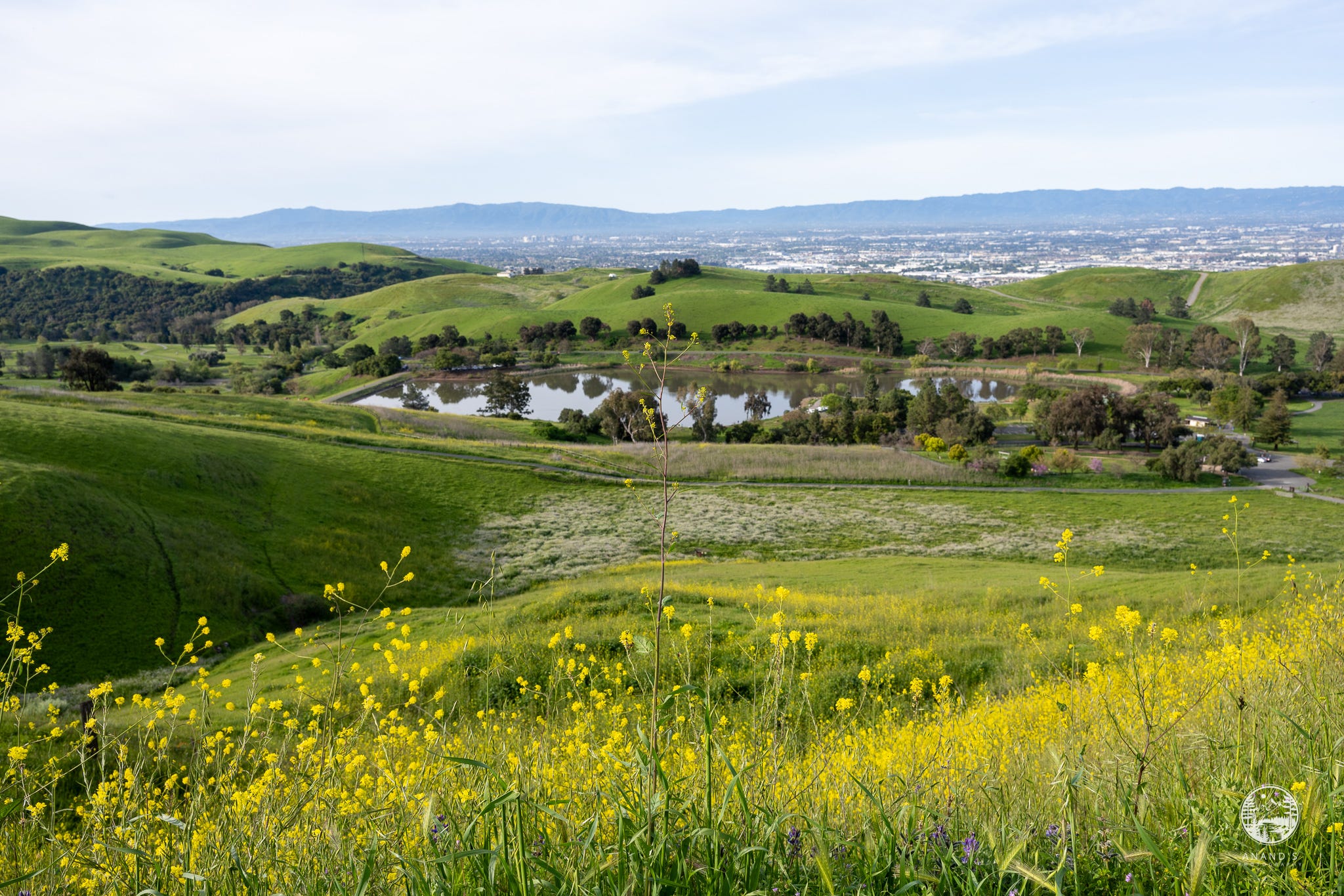
We parked by the Sandy Wool Lake parking lot and started the hike. The initial ascent is steep, we gained about 500 feet within the first 0.75 miles and the wildflowers are around you almost immediately.
Within the first mile, there is a paragliding launch area with a road access to it. The scenery starts to get greener.
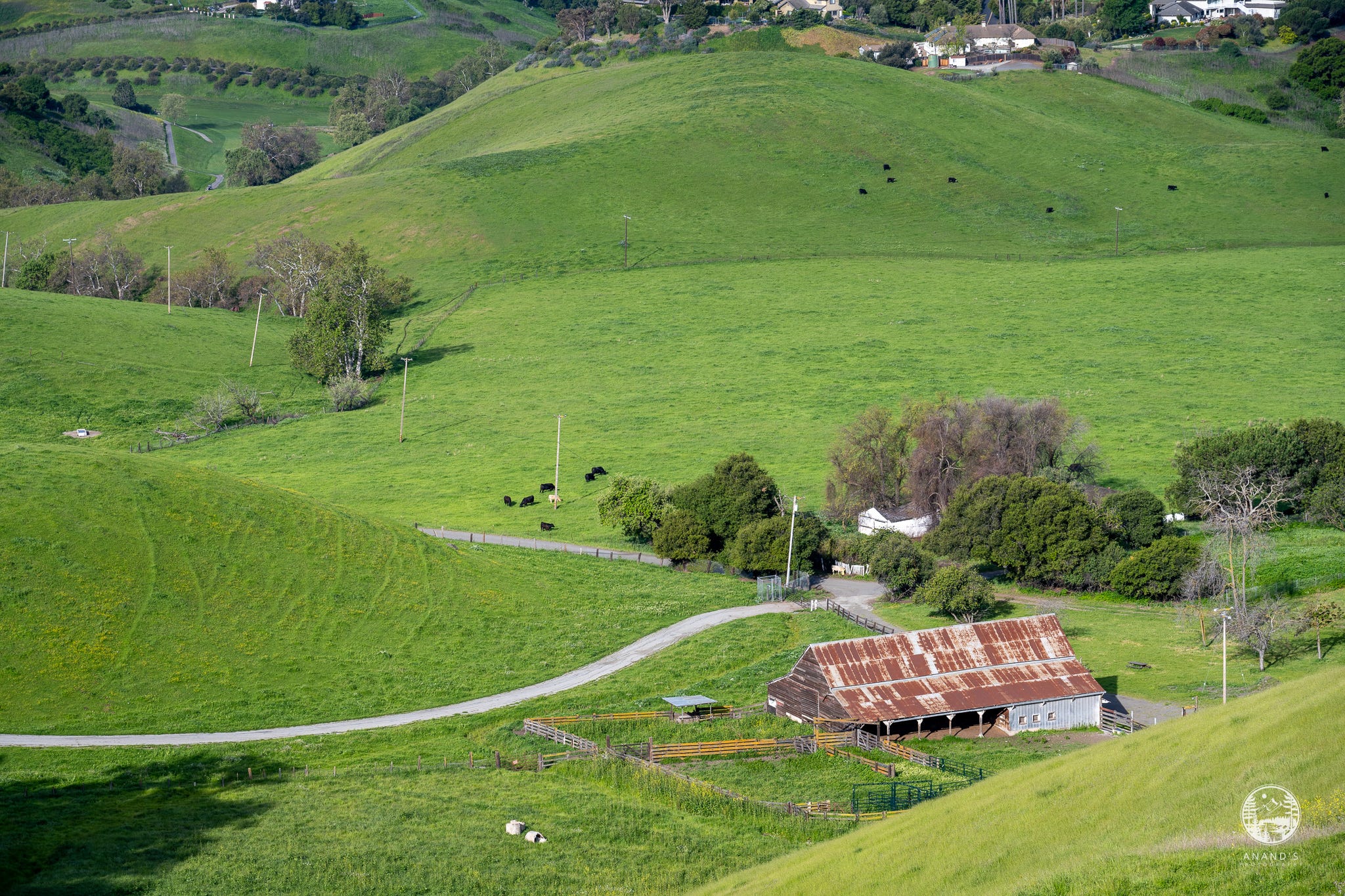
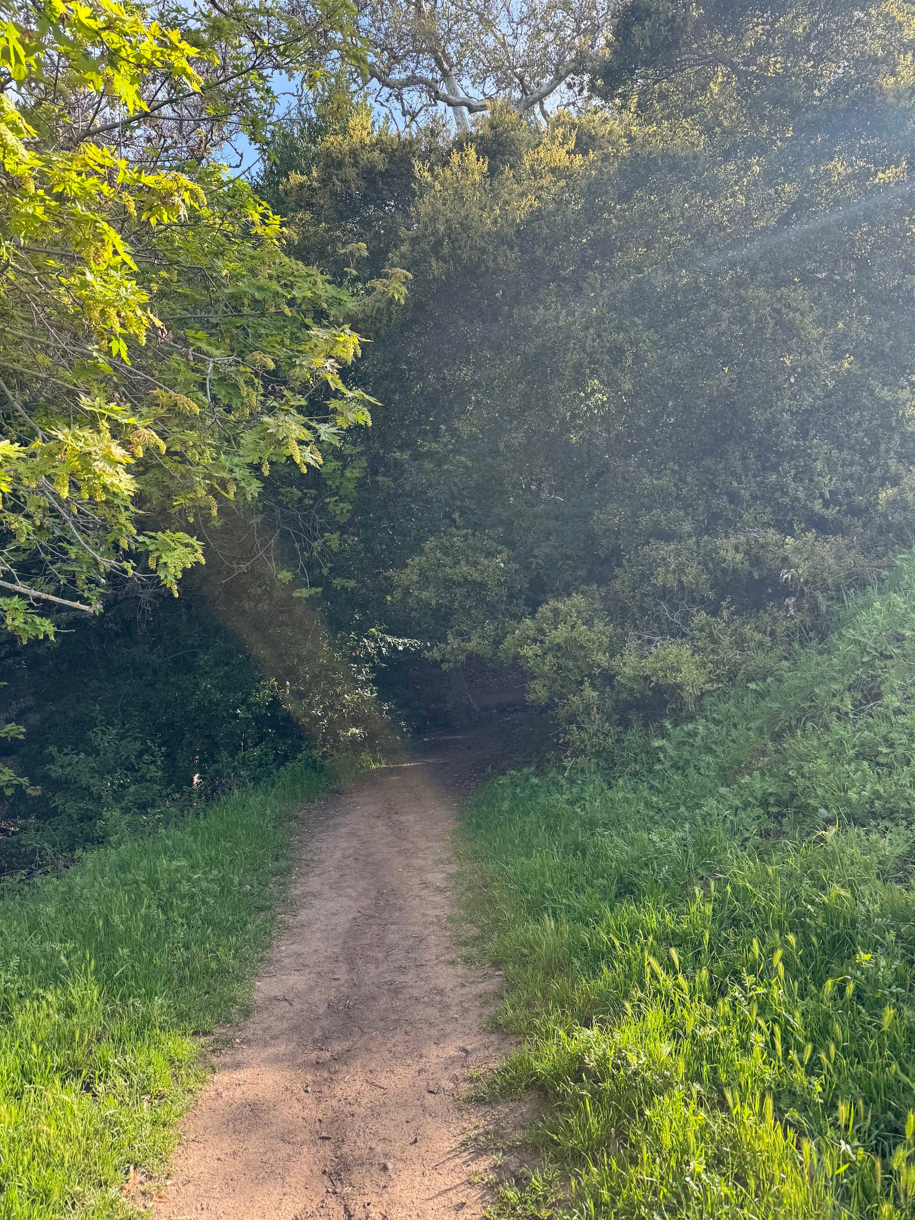
There are unexpected areas of shade in the trail, which makes it rather pleasant to hike.
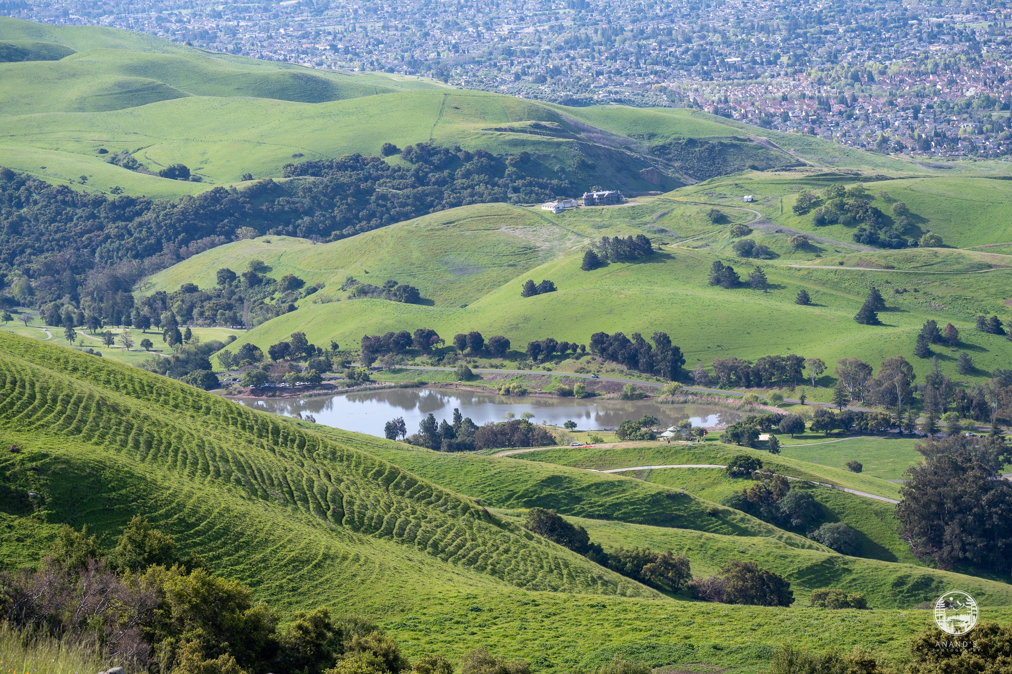
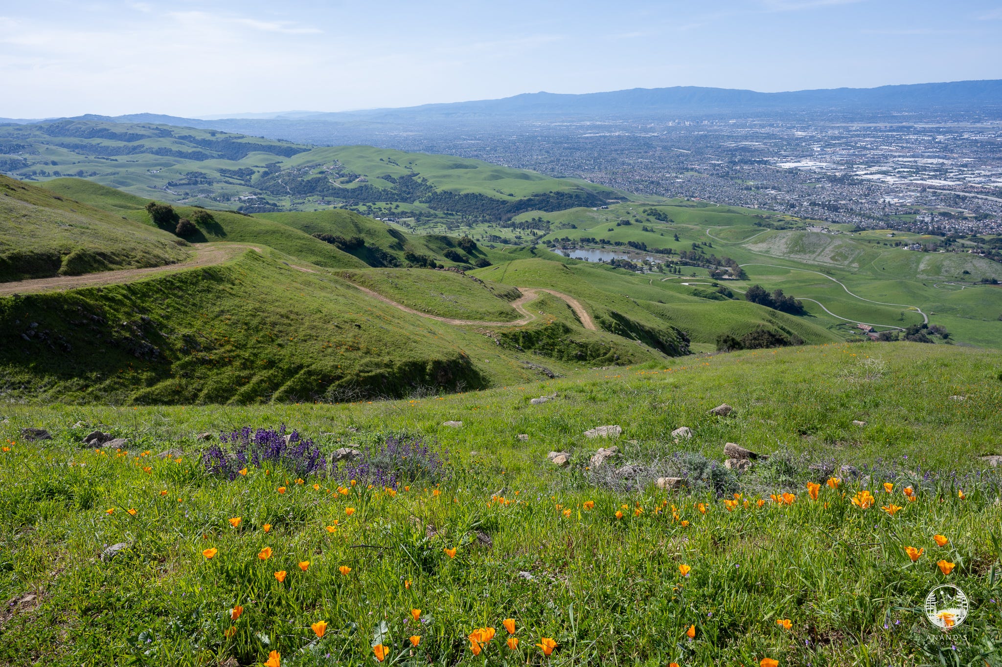
I am not a big fan of hikes where you can see your car’s parking lot all the way to the summit of your hike :), this was one such hikes, but you start to see the greater Bay Area come into focus. Downtown San Jose comes into view, and you identify the landmarks, Hwy 680, Hwy 880, Hwy 237 and you can spot familiar places in and around Milpitas.
Once we climbed about 1,000 feet, poppies started to appear, along with lupines.
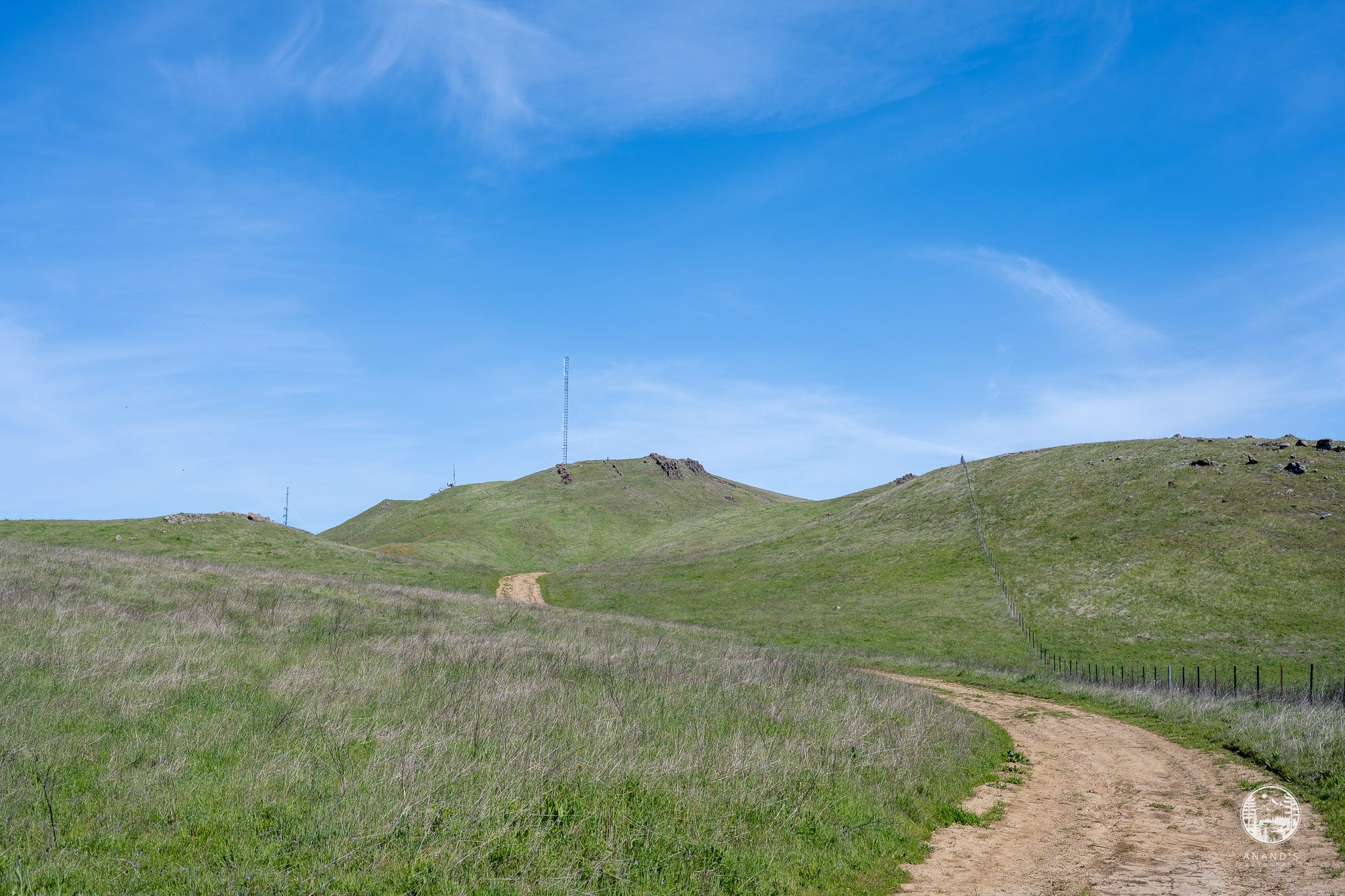
My friend and I followed the alltrails map and turned about 0.5 mile from the summit of Monument peak (photographed here). It was another 500 feet of climb. We had a hard stop at noon and we didn’t have enough time to summit and return (saving this for another day). By 10 am early April (Apr 5, 2025), this got hot enough to make it a tough hike. Once you go past about 2,000 feet, there is little shade or cover, so go prepared with a lot of water.
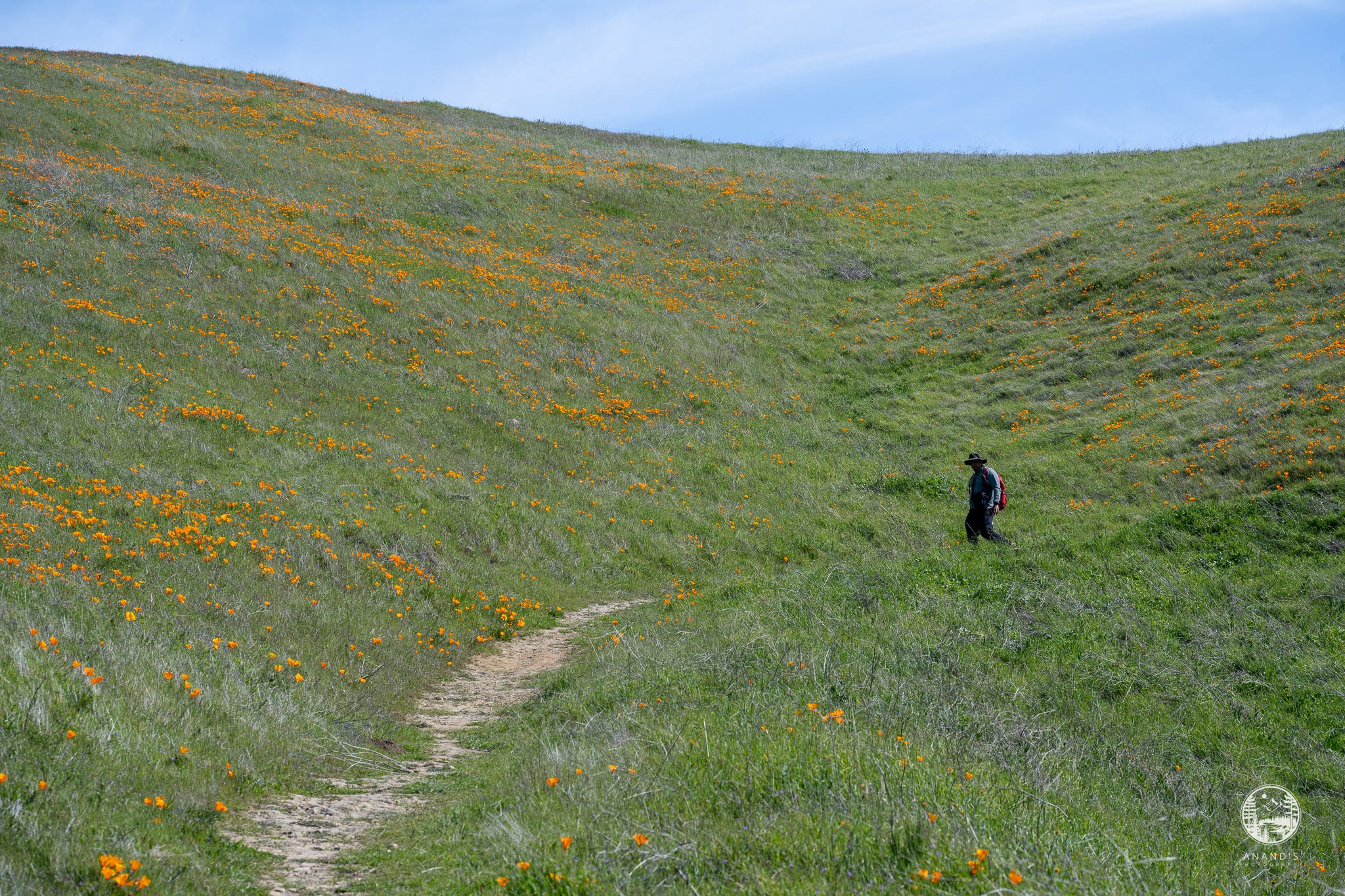
Once you reach this junction, you have a choice of backing up along the Monument peak trail, or All Trails suggested we loop around the Sierra Trail, which was a tad bit longer. Thankfully, we took the Sierra Trail, which turned out to be a blessing. The Sierra Trail is less traveled, so the trail barely has space for a single person to hike and often even that is covered in grass - this may not be a pleasant trail to hike during or just after rains, but there were poppies EVERYWHERE in this trail.
Along the Sierra trail, your view is a bit more North, you see the views of the bay, Alviso, Dumbarton bridge and as the crow flies, I was able to see Redwood Shores, and all the way to San Mateo.
I really enjoyed this hike, although it is fairly steep at times with sharp gradient rises (AllTrails correctly labels this as a hard hike). I think this is a harder hike than Mission Peak, and at least this time of the year, it is a far better hike than Mission Peak. We hiked this on a Saturday morning and we only saw about 10-15 hikers in total within two miles of the summit - there were a lot of hikers going up around noon when we were coming down, but in that heat, I don’t think they were going really far.
I can’t wait to get back on this park and do a lot more hikes. There also appears to be a trail between Monument Peak to Mission Peak, so that long awaited backpacking trip from Fremont to Livermore should actually be a multi day hike from Milpitas to Livermore.
I expect this to be a very hot hike during Summer, but for Spring and Fall, this is a very pleasant hike.