Pohono Trail
The South Rim of Yosemite Valley

The Pohono Trail runs from Glacier Point to Tunnel View along the South Rim of the Yosemite Valley. It is the only trail where you can see all the waterfalls of the Yosemite Valley in the same trail. It has some astonishing views from the South Rim of Yosemite Valley.
I have hiked this trail thrice.
Pohono trail with overnight stop at Dewey Point
The entire trail from Glacier Point down to Tunnel View as a overnight backpacking trip with a night stay at Dewey Point.
This is day 1 of Pohono trail from Glacier Point to Dewey Point.
This is day 2 from Dewey Point to Tunnel View.
We left a bit late on day 1 since we got the permit from Yosemite Valley at around 11am. We then drove two cars from the valley floor, parked one car at Tunnel View, piled into one car and drove to Glacier point.
We then walked down to Tunnel View, drove that one car back to Glacier point and picked up the second car and drove back.
As with all through hikes, it is a logistical nightmare, but totally worth it.
I highly recommend this as a through hike from Glacier Point to Tunnel View, but Glacier point road is closed in 2022, so it is hard to do this hike that way.

Within a couple of miles on the trail, you will see all the three sections of Yosemite falls in one frame. One of the two places where you can see this. The other place is along the four mile trail.

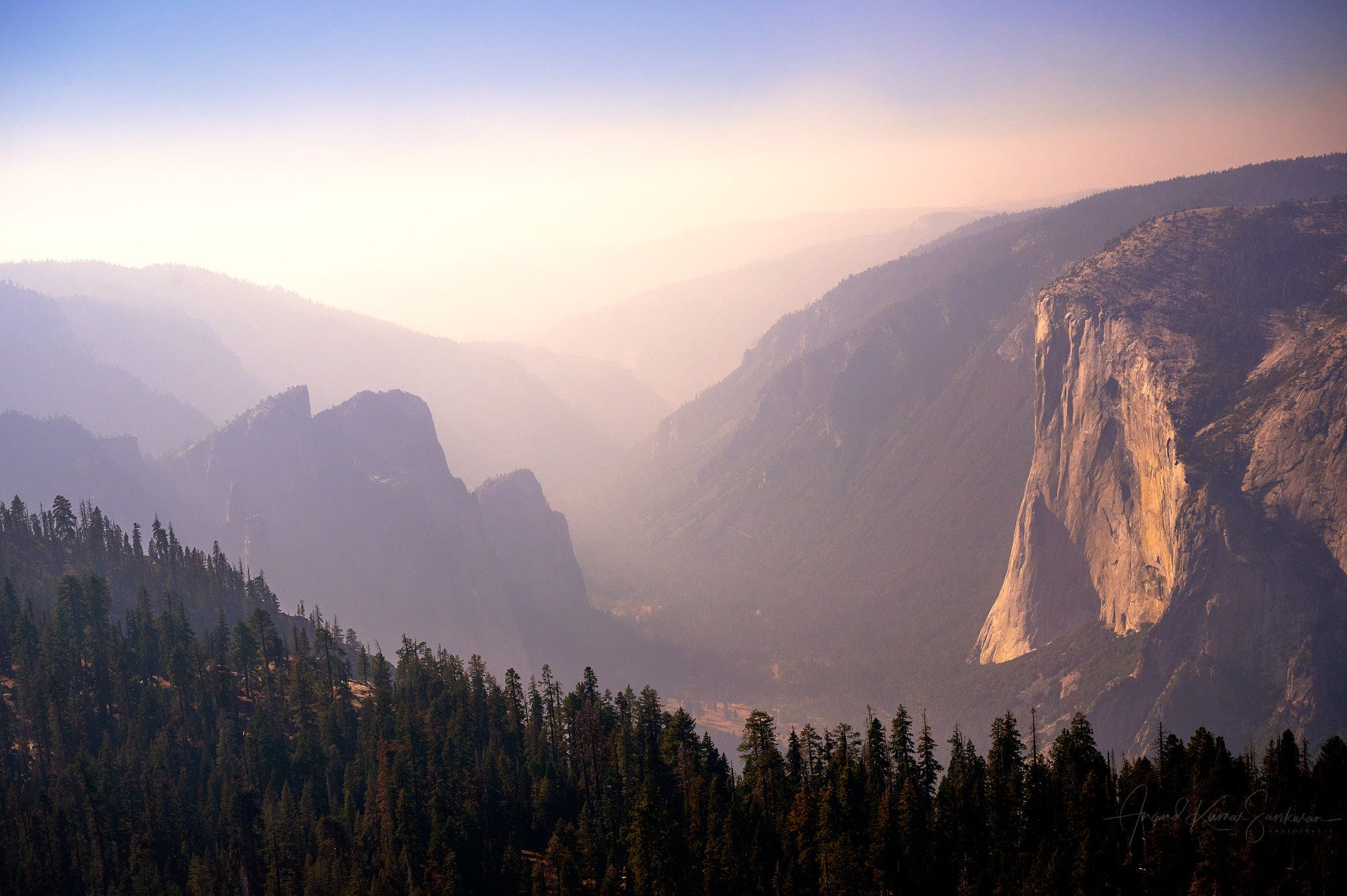
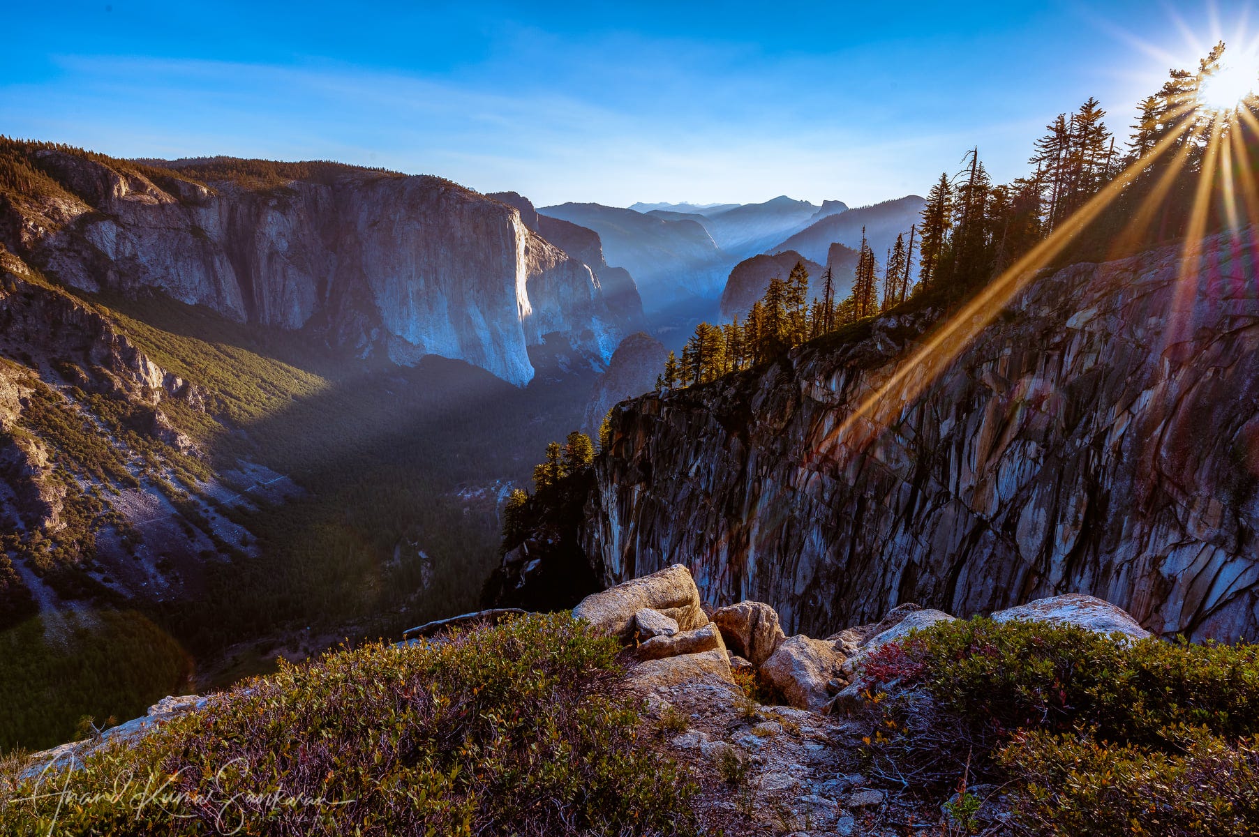
The joy of Pohono trail (and four mile trail) is the view knows as “reverse tunnel view”, as you walk along Pohono trail, you will see El Capitan from the East, then be directly across from it and then finally the Tunnel view.


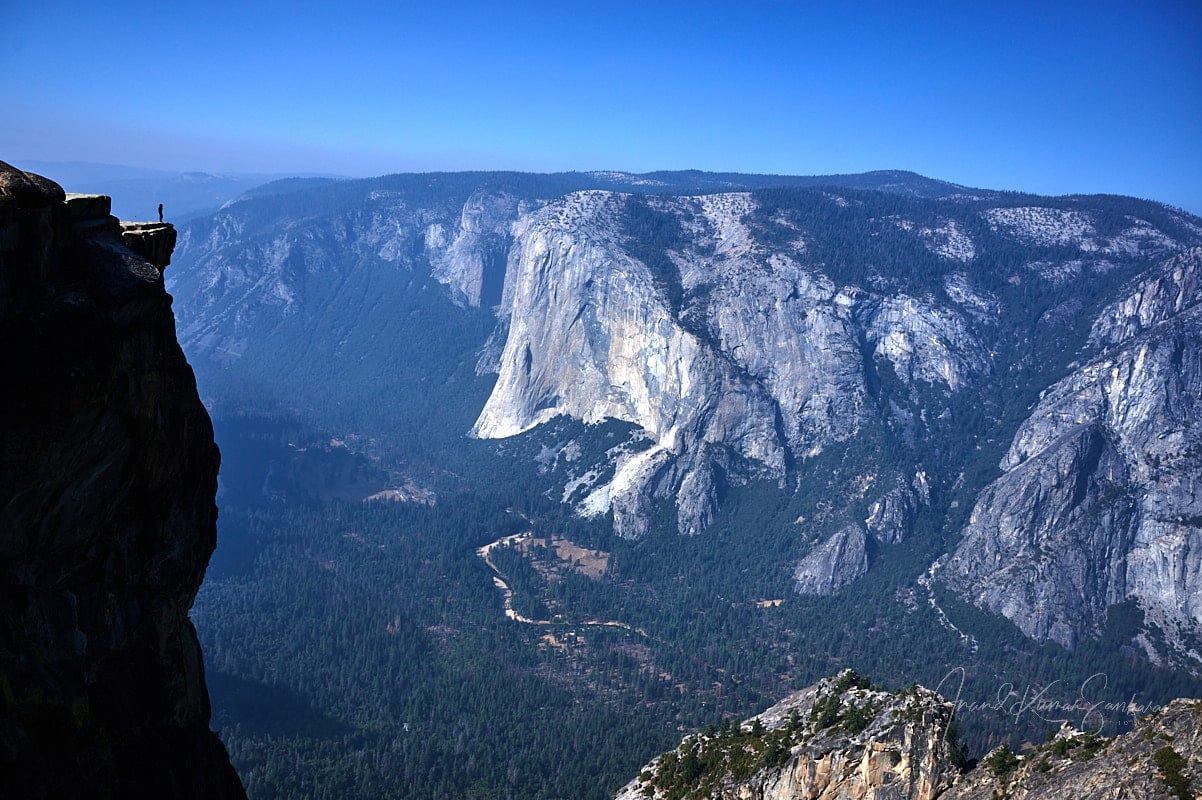
Taft point is probably the most popular vista point along this trail.

Dewey Point presents a very different view of El Capitan. You are also directly above Cathedral peaks. We stayed with this view for the night, on the cliff.
There is no water at Dewey Point, so you need to carry water from Bridalveil creek (that becomes Bridalveil falls shortly thereafter).

The trail kicks up a notch after that, here is my friend Durgi soaking in the trail.

One of the final vista points along the trail is Inspiration point.

Short section hike of Sentinel dome and Taft point
A short section hike over a few hours as part of the Sentinel dome, Taft point loop
This is the strava recording of the loop. This is one of the biggest bang for the buck hikes in Yosemite and can be completed in 2-3 hours.
The hike to Taft Point is spectacular in fall.
There are fearless people on Taft Point.
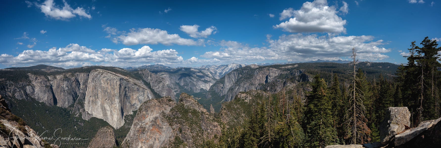
Sentinel dome is one of the best view points to look down upon the valley. We hiked it on a smokey October evening. Go here for sunset.
Overnight to Stanford point
An overnight backpacking trip from McGurk Meadow to Stanford Point and back.
This is day 1 of the hike, McGurk Meadow to Stanford Point.
This is day 2 of the hike, in the reverse direction.
If you do not want to deal with the logistics of a through hike, this is probably the best hike along Pohono Trail.
Dewey point takes a different character with the clouds.
No better place to watch El Capitan at night than Stanford point.
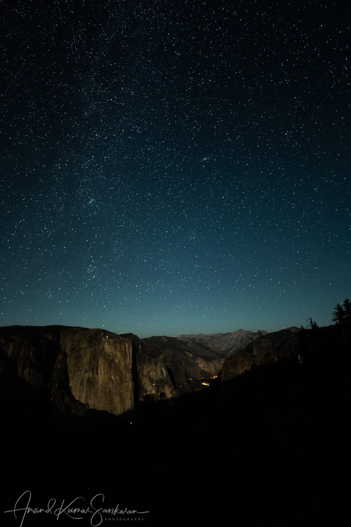
We camped right at this spot. Sunrise was absolutely stunning.
We had to carry water from Bridalview Creek for Stanford point as well. You need enough water for that night, the next morning and the hike back to the creek, we ended up carrying a gallon per person.